
Site Selection Factors Series: #2 Highway Accessibility
February 13, 2017
What Transportation Means to Our Community
The goal of this blog is to write about what “transportation” means to our community and how it specially impacts our lives. In this entry, I’d like to provide a general overview of what transportation is and why it matters.
The most important thing about transportation is that development – cities, towns, businesses, homes – follows it. In the entirety of human settlement, development has never taken place without a way to reach it. From foot paths to waterways, from streets to railroads and highways, villages, towns, and cities developed where pathways led.
In turn, transportation has impacted the shape, form, and function of our communities. In rural areas, farms located along paths to markets in towns and cities. In the north-central region of North Carolina and Virginia, many of these farm-to-market paths had once been used by native Americans, and then by succeeding waves of European settlers.
The farm-to-market paths, where they intersected with other paths, were typically places where commerce, civic and social life emerged. In these places, modes of transportation determined how these places grew. There are three fundamental modes of transportation that influenced how our towns and cities grew.
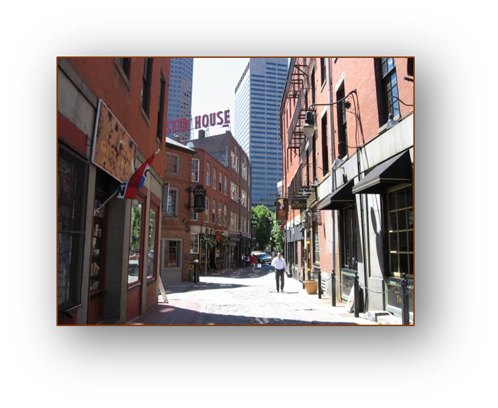
Walking Cities
Were (and are) dense, mixed use areas no more than 5 miles across. These were the major urban form for 8000 years.
Rail Transit Cities from 1850-1950
Were based on trams and trains which meant they could spread 5 to 20 miles with dense clusters of corridors following the rail lines and stations.
![]()
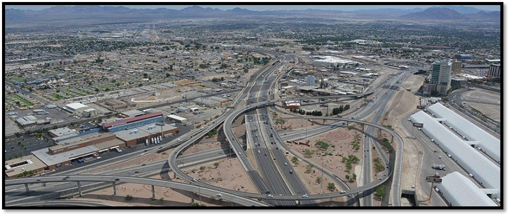
Automobile-Oriented Development
Motorized personal transportation allowed towns and cities to spread 30 – 50 miles and more in all directions and at low densities. Land farm from town and city centers could be developed for residential and industrial uses.
These three modes of transportation, the networks (or paths) of movement associated with them, and the patterns of development fashioned by them, directly impact the health, safety, and welfare of our communities.
So, what are the ways that transportation impacts our personal health, safety, and welfare? In this context, health refers to physical health, safety refers to the ability to travel without fear of injury, and, welfare refers to economic conditions.
For residents, our ability to access healthcare and recreation impacts our physical health; ensuring our transportation systems minimize car crashes and maximize the physical safety of pedestrians, bicyclists, and the disabled enhances our physical safety; being able to move and access goods and services, and being able to access employment, education, and training impact the economic growth of our communities.
How does transportation impact the health, safety, and welfare of our communities? The built form of our communities is determined by the development that follows transportation networks and facilities. Let’s look at how a compact pattern of development that accommodates multiple modes of mobility or movement compares to the pattern of development that is largely accessible only to people in cars. The image below compares downtown Asheville to suburban Asheville. For the fiscal health of Asheville, the “Downtown Mixed-Use” option is arguably better for the welfare of the City of Asheville. This doesn’t mean that communities should forfeit one pattern of development for another, but it’s something successful communities are balancing.

In Person County, the primary mode of transportation is the automobile. Like most places in the United States, motorized vehicles are critical components in our transportation network. But, 50 years ago, Personians largely worked, shopped, and lived within walking distance of their destinations, and this gave them the option to move around without a car. Arguably, 50 years ago, work, shopping, and housing were more accessible than today. The elderly were more likely to “age in place” and children were more likely to walk to school. Parents could walk to work at the mills that operated in town.
Let us consider the following:
COST TO OWN A CAR
Per the American Automobile Association (AAA), $9000 is the average cost to own and operate a vehicle that is reliable so that we don’t miss work or school or can access healthcare when we need it.
HOW WE TRAVEL
- 87 percent of daily trips take place in personal vehicles
- 91 percent of people commuting to work use personal vehicles
HOW MANY TRIPS WE TAKE EVERY DAY
- Americans take 1.1 billion trips a day — four for every person in the U.S
- U.S. daily travel averages 11 billion miles a day — almost 40 miles per person per day
HOW MANY TRIPS WE TAKE IN A YEAR
- Americans take 411 billion daily trips a year or about 1,500 trips per person
- U.S. daily travel totals about 4 trillion miles — 14,500 miles per person
WHY WE TRAVEL
- 45 percent of daily trips are taken for shopping and errands
- 27 percent of daily trips are social and recreational, such as visiting a friend
- 15 percent of daily trips are taken for commuting
WHAT WE DRIVE
- There are 204 million personal vehicles available for regular use
- 57 percent are cars or station wagons
- 21 percent are vans or SUVs
- 19 percent are light trucks
WHEN WE TRAVEL
- The most daily trips are made on Friday (16 percent)
- The fewest daily trips are made on Sunday (13 percent)
- More daily trips are taken between noon and 1 p.m. (7.4 percent) than between 8 a.m. - 9 a.m. (5.5 percent)
THE AVERAGE DRIVER
- Spends 55 minutes a day behind the wheel
- Drives 29 miles a day
MEN VS. WOMEN
- Women drive less (21 to 38 miles per day)
- Men drive longer (67 to 44 minutes per day)
Tying together transportation and the health, safety, welfare of residents and the communities should include the following considerations and principles when making development decisions.
- Think land use AND transportation.
Before approving a subdivision or rezoning, consider what road design and improvements will be needed to support the development, and link it to the surrounding area.
- Identify and plan for growth areas.
Incremental and uncoordinated development will not lead to a livable community or a healthy business climate. Support economic growth by planning and investing in a local road network to support development.
- Develop a complete hierarchy of roads.
A viable community requires a variety of roadways organized as an integrated system. Highways and arterials are needed for longer, higher speed trips. Local streets and collectors provide access to homes and businesses. Recognize that different roads serve different purposes.
![]()
- Link access regulations to roadway function.
Access requirements in your zoning and subdivision regulations should fit each roadway’s functional classification. Recognize that the greatest access control is needed for those roads intended to serve longer, higher speed trips.
- Avoid strip development. Promote commercial nodes.
Commercial development can be located adjacent to and visible from the highway, but should be accessed via a system of parallel local roads and side streets that complement the state highway system.
- Connect local streets between subdivisions.
Give your residents convenient options for travel from one neighborhood to another by connecting local streets from one subdivision to the next.
![]()
- Design subdivisions with access onto local streets.
Avoid lot designs with driveways that enter onto major state or county highways. Orient business and residential driveways to local streets that feed onto the highway at a few carefully designed and spaced intersections.
- Practice good site planning principles.
Locate entrances away from intersection corners and turn lanes. Provide adequate space on the site for trucks to maneuver and for vehicles to queue at drive-through windows without backing or stacking on the roadway. Adjacent businesses should provide shared driveways and cross access so customers can make multiple stops without entering the arterial.
- Correct existing problems as opportunities arise.
Adopt a long-range vision for improving access along older, developed corridors. Correct unsafe accesses as individual parcels expand or redevelop. Work with affected property owners to consolidate driveways and provide internal access between parcels. Fill in the supporting roadway network with local access roads as part of the redevelopment process.
- Manage Access. Why Manage Access? Too many driveways, intersections, and closely-spaced traffic signals along major roads cause problems:
- Crashes increase as vehicles cross and turn along the road in an uncoordinated manner;
- Stop and go conditions frustrate commuters and residents;
- Adjacent businesses suffer when customers have trouble turning into their sites;
- Freight and delivery trucks lose time and money stuck in traffic;
- Pedestrians can’t find a safe spot to cross the road;
- Overall community livability suffers.
Effective access management will:
- Reduce congestion and crashes;
- Preserve road capacity and postpone the need for roadway widening;
- Improve travel times for the delivery of goods and services;
- Ease movement between destinations;
- Support local economic development by protecting major transportation corridors like US501 and US158 so efficient access to/from the County is maintained.
The next entry, I’ll write about some specific projects and long-range planning efforts and the funding environment for projects.
This entry was submitted by Mr. Michael Ciriello. Although Mike currently serves as the Director of Development for the Town of Enfield Connecticut, he formerly served as the Planning Director for Person County, NC, and, prior to that, as Regional Planning Director for Kerr-Tar Regional Council of Governments.
ADD ITEM TO REPORT
As you navigate our website, you can use the “Add Item to Report” button to add any page or property to a custom report that you can print out or save.